
Make informed decisions faster with data you can rely on
Decisions are critical when managing your environment and when you’re planning, designing, constructing and maintaining your major assets. Tasks are highly sequential and therefore time sensitive. The absence or delay of the right data at the right time impacts the quality of your decision making. Poor decisions can be costly to undo, or even irreversible.
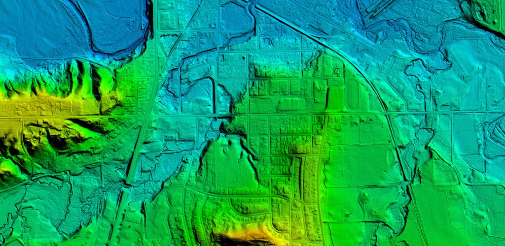
AAM’s Aerial LiDAR surveying delivers data in a matter of days so you can avoid costly delays and act fast when it’s needed.
Our expertise ensures that your data is fit for purpose. Higher accuracy isn’t always better, you need just enough of the right type of data to make informed decisions. Too little data, and your knowledge is incomplete. Too much data and you are overwhelmed. We help you determine the right type and accuracy of your LiDAR data so you get your desired outcomes.
Why use Geo-cart airborne LiDAR surveying

Geo-Cart has the people, systems and technology to deliver LiDAR data faster than anyone else in the market. Manage your interdependent tasks and teams with greater ease by getting reliable LiDAR data delivered as quickly as you need it.

We understand the science and principles that underpin geospatial data, photogrammetry, geodesy and information technology. Our expertise ensures you don’t just get more data, you get data that helps you make more informed decisions.
Enhance your decisions with useable LiDAR data
Enhance your decisions with useable LiDAR data
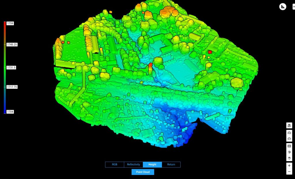
Sometimes your LiDAR survey dataset is so large and complex it’s hard to decipher. Or perhaps the survey technologies used to capture your data failed to deliver information you could actually use. Making critical decisions is difficult when you don’t understand your data or how to derive actionable insights from it.
We can help you to understand the what, why, when and how of the LiDAR technology and survey methods used to capture and deliver your data. This helps you to properly assess our recommendations. Together, we can find the optimal solution to solve your problem.
Geo-Cart’s Aerial LiDAR survey delivers data that you can understand, so you can make more informed decisions fast.